Uncover the mysteries of your infrastructure with cutting-edge geophysics and subsurface testing services.
VCS Engineering uses advanced geophysics, subsurface testing methods, and state-of-the-art equipment to provide valuable data on subsurface conditions. This allows our clients to make informed decisions and reduce the chance of costly issues. Our advanced testing includes identifying unknown foundation or subsurface conditions, soil layering, and composition.
Our team of experts has the experience and expertise to provide accurate and reliable testing services that comply with all regulatory requirements. We work closely with our clients to understand their needs and tailor our services to meet their specific project goals.
At VCS, we're committed to providing the highest quality of service. We pride ourselves on our attention to detail and our ability to deliver results that exceed expectations.
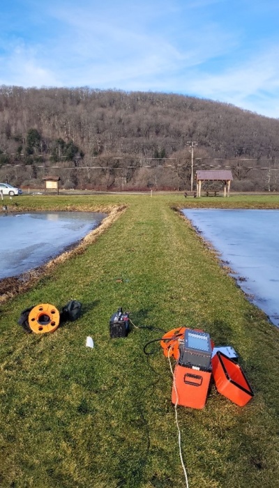
Methods
Our experts will help you determine which methods are most effective and economical for your needs.
Cross-Hole Compressional and Shear Wave Measurements
We assess the soil between multiple boreholes using the cross-hole methodology. Using seismic compressional wave velocity data, we classify materials based on their mechanical properties as determined by the velocity of the seismic wave transmitted through the material. These measurements provide a velocity profile showing high and low-velocity layers. The crossing paths also provide data that detect horizontal and vertical discontinuities, such as high/low-velocity pockets, which may be present in the soil strata.
Electrical Resistivity
We use the electrical resistivity of soils to determine locations where there may be high moisture infiltration or soils that may be corrosive. Low resistivity areas indicate soils that provide a favorable environment for corrosion activity. Resistivity measurements can also identify seepage locations in soils and earthen dams, as moisture content is one of the most significant influences on resistivity. A critical application for soil resistivity testing is identifying potential leakage paths under earthen dams, dikes, and concrete spillways. Seepage under these dam structures creates low resistivity zones that can be identified with resistivity. In addition, sinkholes can be located using resistivity measurements.
Magnetic Measurements
Magnetic surveying is a passive geophysical technique that measures the strength of the Earth's magnetic field. Magnetic surveying is a valuable tool for site studies to locate and identify buried ferrous metal objects such as pipelines, barrels, tanks, etc., as they generally produce a perturbation in the earth's naturally occurring magnetic field. Magnetic Measurements can also be collected in boreholes to detect steel pile lengths.
Parallel Seismic Data
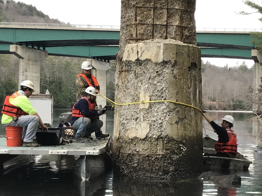
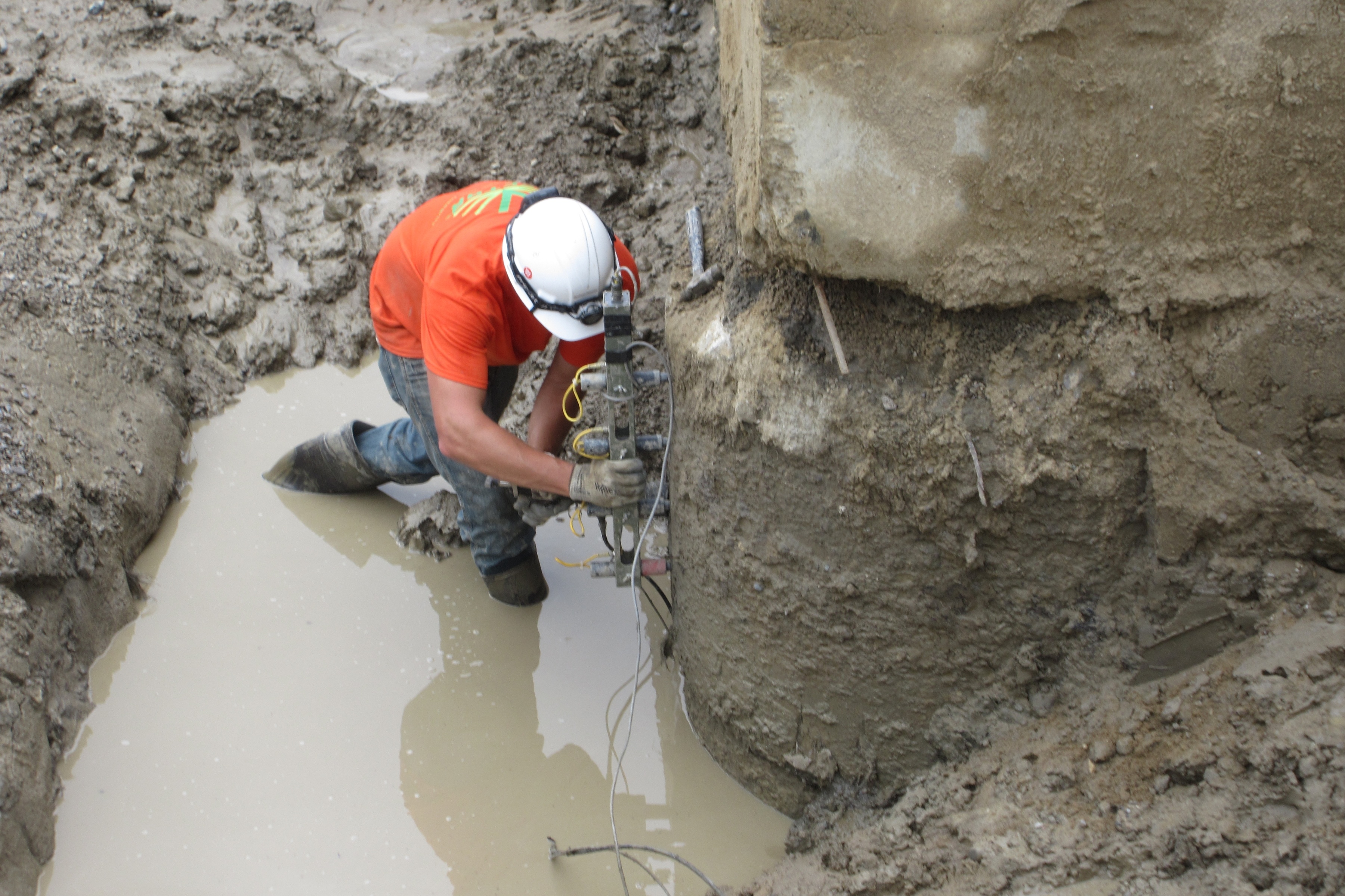
We collect parallel seismic data with a borehole adjacent to pilings. Parallel seismic measurements use a timber/concrete/steel pile as a waveguide and measure the time required for a wave generated on the pile cap to travel from the top of the pile to the bottom of the pile. Because the pile velocity values are higher than the surrounding soils, we can use wave arrivals measured in a nearby borehole to determine where the end of the pile is.
Pile Integrity Testing - Sonic Echo
We can determine the length of steel, wood, and concrete piles using the Pile Integrity Test (PIT) method, also known as the sonic integrity test, sonic reflection, or sonic echo. This method measures the time required for a stress wave generated by a hammer impact to travel from the top to the bottom of the pile and be reflected back to the top. PIT can also detect any significant damage or other defects along its length.
Seismic Refraction and Reflection
In seismic refraction and reflection surveys, we use compressional wave data to evaluate material types and thickness, profile the top of bedrock, and determine the approximate depth to layer interfaces. In addition, we use these surveys to determine soil layer thickness and velocities, which we can use to characterize soil composition. At VCS, we process the data and create a profile of the various soil layers and bedrock, including thicknesses obtained from the compressional wave velocities for each layer.
Vertical Seismic Profiling
At VCS, we use vertical seismic profiling (VSP) compressional and shear wave measurements to determine soil and bedrock's compressional and shear wave velocity using a single receiver borehole and surface energy locations. We position the sensor in the borehole, and seismic energy is generated independently at multiple surface locations to generate wave paths to each sensor.
Project Experience
We provide extensive experience across a range of structures and environmental conditions.

Where it Applies
Service offerings are relevant across these sectors.